im going to explain how to make maps using these tools:
Google earth
MICRODEM
Topographical overlay for google earth
Geo control 2 (there is a 30 day demo, i have full version)
BF2 T-paint
WINRAR
SLICE
Photoshop or another image editing tool
Before you start this tutorial i want you to make a new map in the bf2 editor with the name you choose.
GOOGLE EARTH
this will most likely not work as its outdated, get your files from this interface instead:
http://srtm.csi.cgiar.org/SELECTION/inputCoord.asp
ok so to start with im going to install all of the program i have listed. then you go to google earth and enable SRTM 4.1 like this:
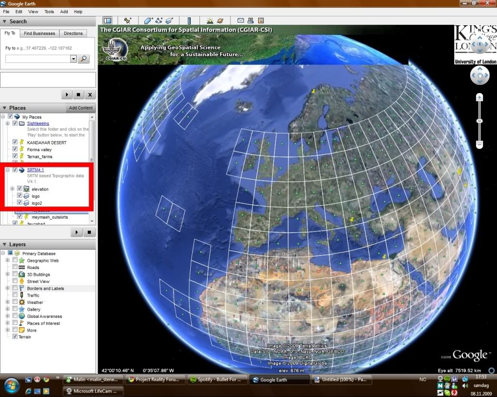
Then you will see lots of large squares in the screen. these are the areas we are going to use.
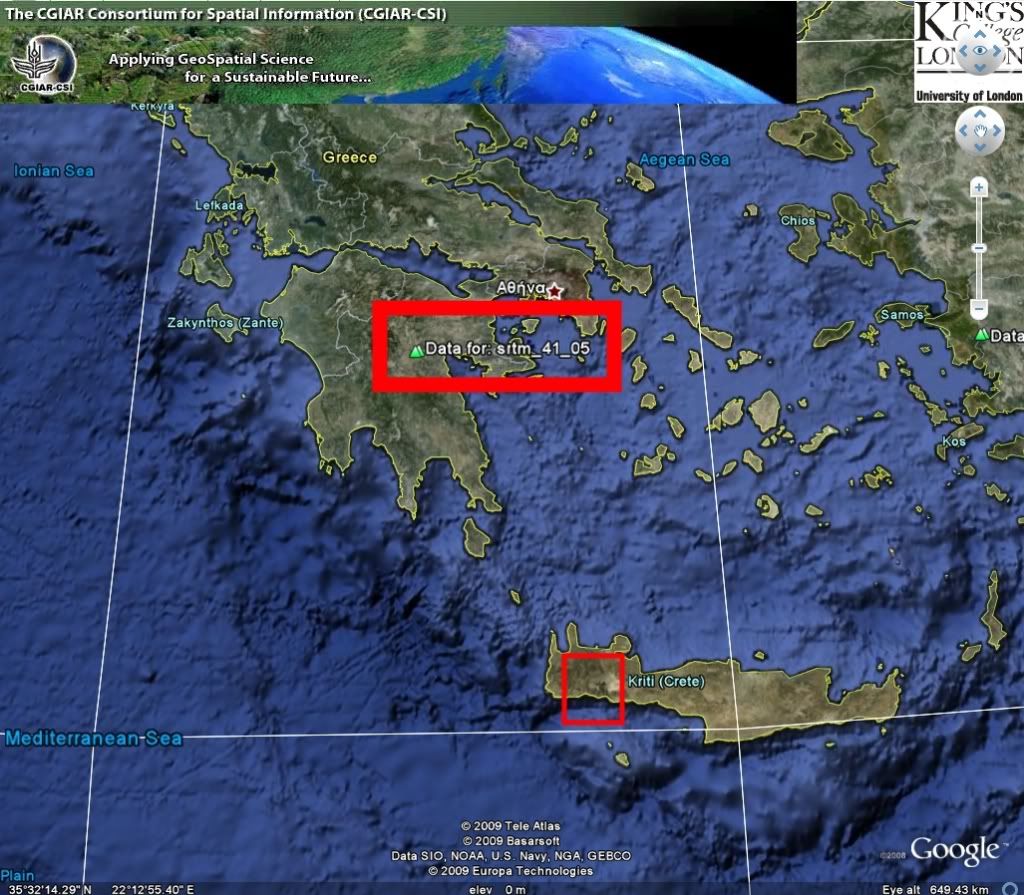
so then you go and find the area you want to use, in this tutorial i will use the Samaria gorge in crete, Greece.
so what you do is to press the "data for XXXXXXX" and dl the link and save somewhere you can find it as marked:
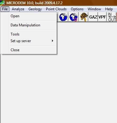
MICRODEM
Then we are going to open "MICRODEM" to scale the huge area that we have downloaded to the area we are going to use.
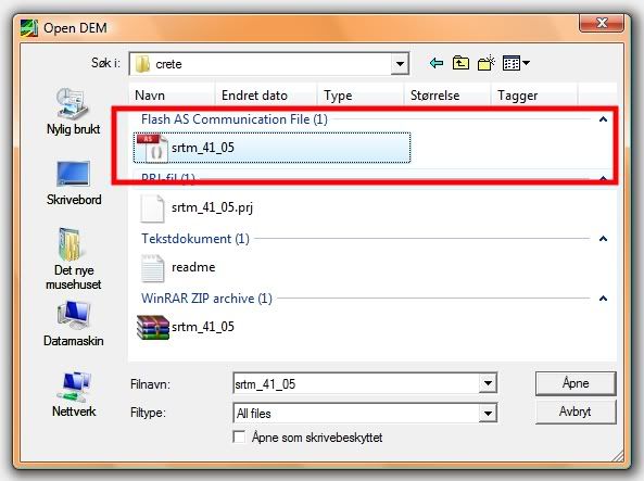
i made a folder called crete that i put my DEM files into and unpacked it there.
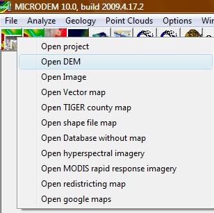
now open the DEM by going to File-open-open DEM- select your dem:
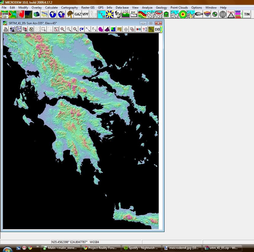
then you will get something like this:
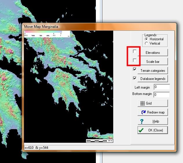
the right click on the image and press legends/marginalia
then ummark these boxes:
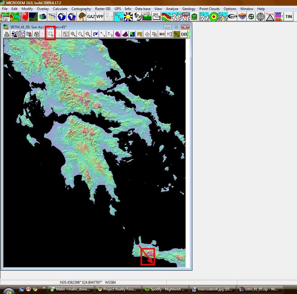
after you have done that we are going to select the area we will use...
the Samaria gorge is located on the southside of crete, so what i do is to select the subset & zoom and select the george from upper left corner to lower right corner.(might take some time to get it right]
now that you have your selected area we will have to convert it to a grayscale image:
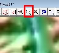
press the "no zoom button"
then right click on the image again and go to display parameter -> elevation and select
gray scale then "ok"
now that we have got our greyscale image we are going to save it as a geotiff file.
go to file -> save map as image -> as GEOTIFF, screen scale(grayscale)
save to the folder where you had the DEM files and save with the exact name:
HeightmapPrimary
now close microdem and go to the folder where you saved it.
PHOTOSHOP
then open the heightmapprimary in photoshop and resize the image to 1024/1024 by going to image -> image size
then you go and save the image as photoshop RAW. and with the exact name: HeightmapPrimary
then open the new heightmapprimary.raw and when the "describe "heightmapprimary.raw" pops up change chanels from 2 to 1 and the depth from 8 bits to 16 bits. and IBM PC not macintosh.
then resize the image again to 1025/1025.
then save and remember to mark the IBM PC not macintosh.
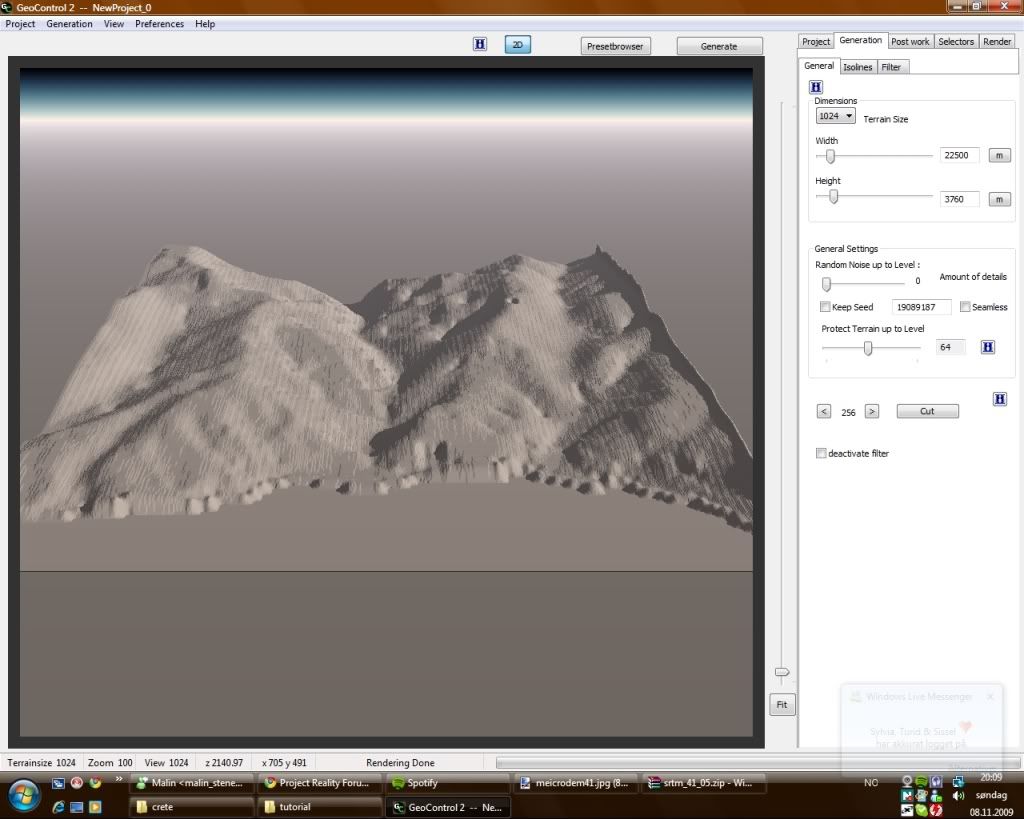
Right now you could have just pasted the HeightmapPrimary.raw into your map folder and i would work fine but what we are going to do is to open it in Geo Control 2.
GEO CONTROL 2
the reason we are going to open the already fine heightmap in geocontrol is to make the map look so much better and also to make a colormap that we can use together with t-paint to make the map look realistic.
so lets open Geo control 2...
go to generation in the top menu and to terrain import.
then choose RAW (16bit) from carrara
then find your heightmap from the folder.
now you can see how the terrain is:
i see that i have som wierd areas on my map along the shore and generaly i want to make the map more interresting...
so what i do is that i go to generation on the right side of the screen and to filters.
there you have 2 standard filters basic and selective noise, you can play around with these to see the effect.
what im going to do is to add a new filter called height correction which will make my mountains look cooler:
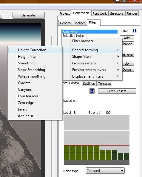
then im going to play around with the sliders under to make it look as i want.
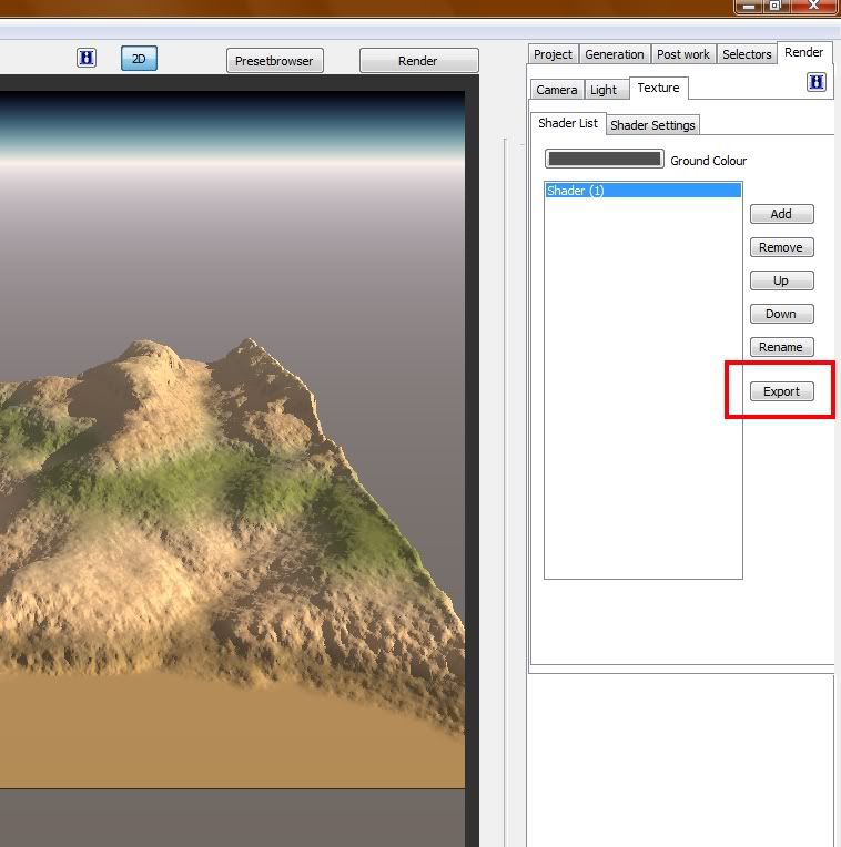
after you got rhe filters right you go to render and texture.
the press gradient and press view in the top left corner, from there choose coloring and choose one from the list that you think will fit.
i used plains for the best result for my map...
now go to generation on the top right and to terrain export, and choose RAW (16bit).
then save as HeightmapPrimary (important that you have that exact name with capaital H and P) into the battlefield 2/mods/your_mod/levels/your_level folder and press yes on overwrite.
now you also have to export the texture that we just created...
for this we are going to use a tool called slice witch slices images into smaler pieces that can be read by the editor.
so in geocontrol go to:
and save in the folder we created in the beginning.
now go there and open it in a img editing program and resize to 4096/4096 and resave as JPEG file.
now open slice and open the image you exported from geo2 and press slice.
now save to my_level -> editor -> colormaps
now that we got our colormap we need our detail map.
we are going to use the t-paint tool to make that.
here is the tutorial for how to use t-paint: BF2 T-paint tutorial
the only thing you have to change is that you dont copy the colormap...
that concludes this tutorial... hope it helps
and dont be afraid to ask if there is something that you dont understand or having trouble with
i will add more pics from the map another da